
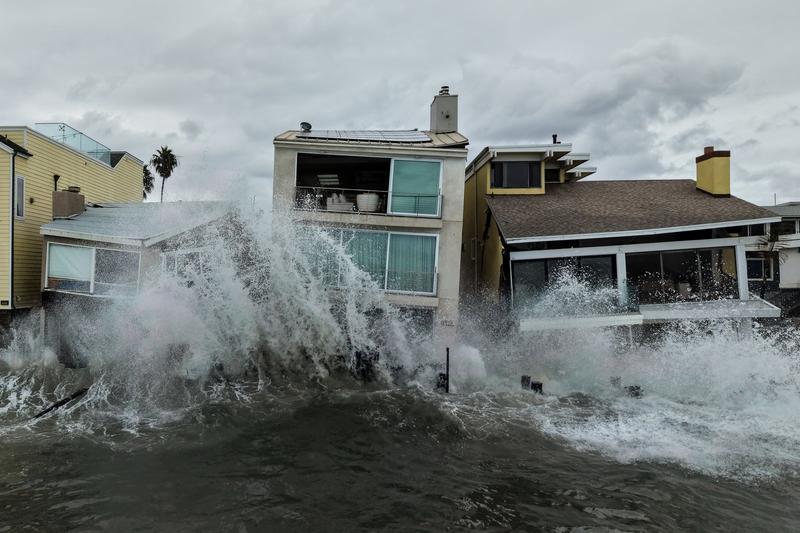
The 2026 eastern and central Pacific hurricane season has set a new record for tropical storm and hurricane activity as of October 12, 2026, driven by a very strong El Niño event. This season has surpassed the 2018 record in terms of the cumulative duration of strong winds, with Hurricane Simon cementing 2026’s place in the record books as the busiest year for storm activity in the eastern and central Pacific Ocean. The World Meteorological Organization (WMO) declared the onset of this El Niño on June 2, 2026, and it is currently considered “very strong,” with a high probability of becoming the strongest on record, potentially exceeding all previous El Niño events in NOAA’s modern record dating back to 1950.
Official Statements and Verified Reaction
The increased hurricane activity is attributed to the ongoing El Niño, which warms equatorial Pacific waters and reduces wind shear, accelerating tropical storm development and intensification. The National Oceanic and Atmospheric Administration (NOAA) has indicated a greater than 90% chance of a very strong El Niño event during the Northern Hemisphere fall and winter of 2026-27. Celeste Saulo, the World Meteorological Organization (WMO) Secretary-General, has emphasized the global implications of such strong climate phenomena. The WMO continues to monitor the situation closely, providing updates on the El Niño’s progression and its potential impacts worldwide, as reported by Independent.
Auto-Enriched Background Context
El Niño, a climate pattern characterized by the unusual warming of surface waters in the eastern equatorial Pacific Ocean, significantly influences global weather patterns. The current 2026-2027 El Niño event, declared by the WMO on June 2, 2026, is projected to be exceptionally powerful. Experts anticipate this El Niño will peak in November or December 2026 and persist through early 2027. Historically, strong El Niño events have been linked to increased tropical cyclone activity in the eastern and central Pacific, while often suppressing activity in the Atlantic basin. This dynamic is due to changes in atmospheric circulation, including altered wind shear and sea surface temperatures.
The impact of El Niño extends beyond hurricane seasons, affecting rainfall patterns, temperatures, and agricultural yields across various regions. For instance, some areas may experience severe droughts, while others face increased flooding. The 2018 hurricane season, previously a benchmark for activity in the Pacific, saw numerous powerful storms. The current 2026 season has now surpassed that record, highlighting the escalating intensity of weather events. The scientific community, including NOAAcontinuously studies these phenomena to improve forecasting and preparedness. Understanding the mechanisms behind El Niño and its interaction with other climate drivers is crucial for mitigating its effects on human populations and ecosystems.
Previous El Niño events have had significant global consequences, from impacting commodity prices to influencing migration patterns. For example, the 1997-1998 El Niño was one of the strongest on record, causing widespread weather anomalies. The current event’s potential to exceed even that benchmark shows the urgency of climate monitoring and adaptation strategies. Organizations like the WMO and NOAA play vital roles in providing timely information and warnings to governments and communities. The ongoing research into climate change and its amplification of natural phenomena like El Niño is critical for future resilience. For more information on global climate patterns and their effects, refer to the World Meteorological Organization’s official website.
Frequently asked questions
What is El Niño?
El Niño is a climate pattern that describes the unusual warming of surface waters in the eastern equatorial Pacific Ocean. It is one phase of a larger phenomenon called the El Niño-Southern Oscillation (ENSO).
How does El Niño affect hurricane activity?
El Niño typically leads to warmer sea surface temperatures and reduced wind shear in the eastern and central Pacific Ocean, which are conditions favorable for the formation and intensification of tropical storms and hurricanes. Conversely, it often suppresses hurricane activity in the Atlantic basin.
Related: NBC’s Scripted Strategy: ‘Line of Fire’ Expansion and Peacock’s Live Focus
When did the current El Niño event begin?
The current El Niño event was declared by the World Meteorological Organization (WMO) on June 2, 2026.
How strong is the current El Niño event?
The current El Niño is considered "very strong" and has a high probability of becoming the strongest on record, potentially exceeding all previous El Niño events in NOAA's modern record dating back to 1950.
When is the current El Niño expected to peak?
The current El Niño is expected to peak in November or December 2026 and persist through early 2027.
Sponsored · Put your business in front of ByteSize Network's readers, with every click measured. See advertising packages · Advertise on ByteSize Network